How Do Scientists Explore a Place Humans Can’t Survive?


 Apple Podcasts

 Spotify

 YouTube

 Amazon Music

 PocketCasts

 Overcast
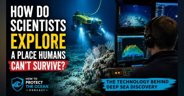
The deep ocean is one of the most extreme places on Earth. Crushing pressure, freezing temperatures, and total darkness make it impossible for humans to explore for long, yet scientists continue to make incredible discoveries thousands of meters below the surface. So how do they do it?
In this episode, you’ll discover the remarkable technology that makes deep sea exploration possible. From remotely operated vehicles and autonomous underwater robots to multibeam sonar, artificial intelligence, and environmental DNA, these tools are transforming how we study one of the least explored parts of our planet. You’ll also learn why mapping the ocean often leads to discoveries scientists never expected to find.
This episode is part three of our four-part series leading up to Friday’s interview with experts from Ocean Networks Canada and Fisheries and Oceans Canada. By the end, you’ll understand why technology is helping scientists ask bigger questions, make new discoveries, and build the knowledge needed to better protect Canada’s deep ocean and the rest of our blue planet.
Map the Gaps: https://www.mapthegaps.org/
Support Independent Podcasts: https://www.speakupforblue.com/patreon
Need help with your ocean non-profit, company, or project? Get the help you need with Pisces Oceans Inc.: https://www.piscesoceans.ca
Connect with Speak Up For Blue
Website: https://bit.ly/3fOF3Wf
Instagram: https://bit.ly/3rIaJSG
TikTok: https://www.tiktok.com/@speakupforblue
Twitter: https://bit.ly/3rHZxpc
YouTube: www.speakupforblue.com/youtube
0:00 Imagine trying to explore Mount Everest without even setting foot on the mountain. That's essentially what ocean scientists do every time they study the deep sea. The only difference? Instead of climbing nearly nine kilometers up, they're exploring thousands of meters down into a place where a human couldn't survive more than a few moments. Probably less than that, if you really think about it. This is the How to Protect the Ocean podcast, your weekday ocean news update. If you care about staying informed on the ocean every single weekday, Monday to Friday, hit that follow button right now so you don't miss tomorrow's story. And if you wanna support the show because you love all the stuff that I do on this podcast, on YouTube, on Instagram, on TikTok, and on Facebook, of course, you can do so by going to speakupforblue.com/patreon.
0:43 That's speakupforblue.com/patreon. Welcome to part three of our four-part series leading up to Friday's interview with DFO scientist and an Ocean Networks Canada educator, all on exploring Canada's deep sea. On Monday, we learned that we've only explored a small fraction of the deep sea. Yesterday, we discovered that the mysterious world is actually filled with incredible marine life. Today we're answering perhaps the biggest question yet. How in the heck do scientists actually explore a place humans can't even safely visit? The answer is one of the greatest technological success stories you've probably never heard about. Let's be honest. Humans weren't built for the deep sea ocean at all.
1:25 By the time you reach 1,000 meters below the surface, the pressure is around 100 times greater than that you're experiencing right now. So you go deeper, and that pressure continues to increase. At the deepest part of the ocean, it's enough to crush an ordinary submarine like an empty soda can. It's completely dark. The water hovers just above freezing. There's no GPS. Radio signals don't work underwater. Even communicating with equipment becomes incredibly difficult. So instead of sending people, scientists send robots. The workhorse of deep sea exploration is something called an ROV. That stands for remotely operated vehicle. Think of it as an underwater robot that's connected to a ship on the surface by a long cable. Operators on board use joysticks, cameras, and sensors to guide the vehicle across the sea floor.
2:11 Modern ROVs aren't just cameras, they're floating laboratories. They can collect rocks, take water samples, measure temperature, capture high-definition video, pick up delicate corals, even retrieve tiny animals for scientific study. It's like having a marine biologist, a geologist, a photographer, and a robotic engineer all working together through one machine. And because they're operated from the ship, scientists can spend hours exploring places no diver could ever reach. Even if you dive at 100 feet. I go diving at 100 feet often. I'm not a big fan of it because it's really deep. I don't love it to be that deep. But what I do when I've gone down there, I spend like maybe 15 minutes at the bottom time. Imagine being able to spend hours looking through a monitor and seeing all this wonderful, amazing stuff.
2:56 In fact, if you've even seen any of the deep sea stuff that Schmidt Ocean Institute has put out, or Monterey Bay has put out, or even Ocean Networks Canada put out, they have amazing footage of the deep sea that you could even see from any social media. If you've ever go on any of their social media, you get to see that stuff, and it's absolutely amazing. Now, before an ROV ever enters the water, scientists need to know where to send it. That's where another incredible technology comes in, the multi-beam sonar. I have to admit, I always wanted a multi-beam sonar. It's a weird thing, I know. I've always wanted one, though. I've always wanted one to put on my boat. Did I say I wanted a boat as well? I always wanted one to put on my boat.
3:36 In fact, when I did my master's, I was doing my GIS analyst diploma at the same time at COGS, the Centre of Geographic Science in Nova Scotia, it was a great program. But I remember driving an hour and a half each way to school and back to my home in Halifax, and I would pick up some people on the way and bring some people home on the weekend and stuff like that. And I had a friend, Chris, and we actually discussed starting a multi-beam sonar company at one point. We were gonna buy multi-beam sonars, we were gonna have a boat, we were gonna do all this mapping of the ocean, of the deep sea, and everything like that. Never happened, of course, but multi-beam sonars are amazing. Instead of using light, ships send sound waves towards the sea floor. Those sound waves bounce back, allowing computers to create detailed maps of underwater landscapes. So imagine mowing your lawn.
4:17 You don't just walk randomly. You move back and forth in organized lines until you've covered every single section. Ocean mapping works much the same way. Research vessels carefully track back and forth across the ocean, collecting millions of sound measurements as they go along. Now, if you picture it like a lawn, like mowing your lawn, for me, I go back and forth, back and forth to make sure I don't miss anything. It takes me a little bit longer, but I do that. But a lot of times if you're just going forward, you're going one track, you go around another track. But the lines are incredibly thin 'cause the multi-beam only goes a certain range down. So as it comes down, it's like a cone shape from the bottom of the boat all the way down to the surface of the ocean. You get this cone shape, and it only covers a certain swath. So the lines are gonna try and overlap that swath to make sure you get all the data in this specific section.
4:59 You're not able to do a lot depending on the swath. So you're not covering a lot of area, but it is kind of interesting, in that way. But eventually, like, the measurements become detailed maps, and scientists can identify underwater mountains called seamounts, which are really cool. They're deep canyons, steep cliffs, ancient landslides, potential coral habitats, places where currents bring nutrients that attract marine life. And those maps become the guidebook for future exploration. And to be honest, if you wanna really look for exploration, there's an organization called Map the Gaps. It's a client of ours at piscesoceans.ca if you wanna go to our website. But Map the Gaps is an organization. I'll put the link in the show notes. It's an organization that's out to map the bottom of the ocean, and actually has a really cool plan where you can basically purchase a hex to get it actually mapped out, and they'll go out and map it out and stuff like that.
5:46 It's really kind of a cool program. Check it out, Map the Gaps. I'm gonna put the link in the show notes so you can check that out, but it's pretty cool. Now here's the exciting part. Every new map often revealed something nobody expected: a ridge that wasn't there before, a canyon that was much deeper than scientists had thought, or a habitat that deserves a bit of a closer look. Sometimes the map itself becomes the discovery. And that's a really kind of a cool thing, 'cause you've probably discovered this podcast just by searching out ocean. You're trying to search a keyword. Imagine doing it using a multi-beam sonar and being able to discover something that's really cool, like a seamount. A seamount is basically these mountains, right? Mountains that are in the ocean, and they have incredible biodiversity at the top of that seamount. And so it's a really cool thing.
6:27 But it's a very unique thing that people, when they pass by, they kinda discover. Just like you were probably searching for something in the ocean, and you passed by and you got to my podcast about how to protect the ocean. You're like, "I need to check this out." And now you're addicted because this is such great material. But if you've just discovered this and you wanna come back to it, and you may not remember the name or whatever that might be, hit the follow button so you don't miss any other episode, and you can always get this rich, rich information, biodiverse information, or diverse information. Not biodiverse, I guess, but it's diverse for sure. We definitely cover a lot of things on ocean conservation. But the technology in the deep sea ocean keeps getting better. Scientists are now combining underwater robots with artificial intelligence, AI, to analyze thousands of hours of video.
7:07 So think about this, like, if you think about the effort that it takes to go on out on a boat, gather all the data, and then be able to bring all that back. Even Ocean Networks Canada, the amount of data that they pump through, it's, like, by the minute. They can even do it by the second if they really wanted to. That all has to be analyzed because you can't understand the ocean without analyzing the data that you actually spent millions upon millions upon millions of dollars to gather, right? To collect. So you gotta use AI and machine learning to actually process the data. And that's gonna become a bigger and bigger part of actually understanding what data's coming in and really identifying trends. So instead of watching every minute of a video themselves, the AI can help identify corals, sponges, fish, and other animals much more quickly.
7:49 Researchers are also using DNA, environmental DNA to be specific, what we call eDNA. Every animal leaves tiny traces of their genetic material in the water. By collecting the seawater, scientists can often determine which species are nearby without even seeing them. Now, it does require that we have a genetic makeup of that species. So species that we haven't discovered yet, we may have that eDNA in there, but we just don't know what that DNA is or who it belongs to. So until we start discovering species and get that makeup of that genome, we won't really know new species in there 'cause we don't have their DNA. As we get better in that respect, we'll get more and more of that DNA, and we'll be able to identify it. It's a little like walking into a room after someone has left and still being able to tell that who was there.
8:32 Like a smell, I guess, in a way. Sometimes that's good, sometimes it's not so good when, when you're walking in a room and you hear, and you smell something that you know that person wears. That smell of a cologne of some sort or a natural smell or whatever. Sometimes it's not that great. It's BO, but we're not gonna get into that because that's gross and we're not gonna talk about that. But autonomous underwater vehicles, we are gonna talk about, or AUVs, they take exploration even further. So unlike ROVs, they don't need a cable to connect them to a ship. They're programmed with a mission, they're like an underwater drone, and explore on their own before returning the data. So when you put all these technologies together, something remarkable happens. We begin to see ocean in ways that simply weren't possible 20 years ago. Scientists can explore deeper, stay underwater longer, collect more information, and answer bigger questions.
9:18 But here's what I find the most inspiring. Technology doesn't replace the scientists. It gives scientists just better tools to ask better questions. Every piece of data still needs a scientist to interpret it. And every video still needs someone to notice something unusual, because AI and machine learning and all that can still miss something that the naked eye can see. Every discovery begins with curiosity. And that's exactly what you're gonna hear about in Friday's interview, because we're gonna be feeding people's curiosity by talking about this educational project where these researchers, using these incredible technologies can answer questions about Canada's deep Pacific Ocean and then share that live sometimes as they're doing these deep sea exploration surveys with people watching it live, like students and so forth.
10:04 Now tomorrow we're gonna finish up our series, our four-part series, by looking at perhaps the most important question of all. Why does exploration matter? We spend the time, the money, the effort exploring places most people will never visit. Because exploration isn't the goal. Protection is. And understanding is. That's why we protect it. And that's where the story becomes even more important. The deep sea is too extreme for humans to explore directly, but technology is allowing us to discover new ecosystems and understanding our planet in ways that weren't possible just a generation ago. It's an incredible time to be a scientist. It's an incredible time to be an engineer. It's an incredible time to be curious about the ocean 'cause we're actually able to see, just regular people, not scientists, just people that are going, minding their own business, you can actually see what's in the deep sea by going on Ocean Networks Canada and looking at their live feeds.
10:53 You can go on Smith Ocean Institute on their live feeds or their videos that they have from their deep sea exploration. There are so many videos being shared, it's actually quite incredible. Some of the videos that we've been able to see have been able to point out and get, sometimes for the first time, deep sea squid, giant squid on camera, which is absolutely incredible, and we continue to find more and more things as we continue to explore. By using these amazing technologies that cost money and, had to go through a lot of trial and error to get into the deep sea and be able to do what they do right, just as what we talked about today. And I'm so excited that I was able to bring that to you. But I would love to hear what you think. Hit me up on Instagram or on TikTok in my DMs. Let me know how you feel about these episodes and what you're learning.
11:38 I always like to know what you'd wanna learn as well. You can hit me up on those DMs or on the social platforms by going to the show notes, where I'm also gonna put in Map the Gap's website. And of course, if you would like to support the show, you can go to speakupforblue.com/patreon. Thank you so much for joining me on today's episode of the How to Protect the Ocean podcast. I am your host, Andrew Lewin. Have a great day. We'll talk to you next time, and happy conservation.